1. Geography
Marina del Rey is an unincorporated district of Los Angeles County, located in the center of Los Angeles’ Westside between Venice Beach and Playa del Rey, and just four miles north of Los Angeles International Airport (LAX).
The community has a population of over 8,000 and is bounded on all sides by the City of Los Angeles: west of Lincoln Boulevard, east of Via Dolce, north of Ballona Creek and south of Washington Boulevard/Oxford Basin, and the Pacific Ocean (which is the area situated closer to the marina waterfront and to the water’s edge).
According to the United States Census Bureau, the city is comprised of 1.5 square miles (3.9 km2). Nine-tenths of a square mile (2.2 km²) is land and 0.6 square miles (1.6 km2) is water (40.91%).
The County of Los Angeles owns the entire land and water, and for that reason, it provides long-term leases to private residents.
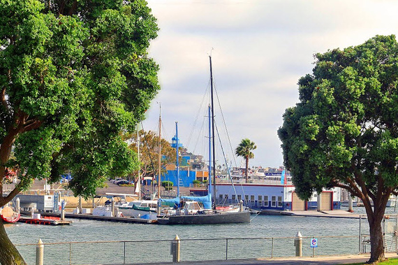
The community’s harbor was constructed in the late 1950s by the Army Corps of Engineers, thanks to a project that was planned and funded by the Federal government, Los Angeles County and private developers. Today, the site is the largest man-made marina in the United States, with over 5,300 small-boat slips; surrounded by high-rise condominiums, hotels, apartments, restaurants and stores.
1.a Climate
Residents of Marina del Rey enjoy a moderate climate year-round. During the summer, temperatures reach highs in the upper 80’s and lows between 45 to 46 degrees in the winter.
The area gets 17 inches of rain per year, and the number of days with any measurable precipitation is 24.
On average, there are 286 sunny days each year in Marina del Rey. The July high is around 84 degrees and the January low is 46.


